Library search
Search Results
-
 The expression of social dexterity in Uzbek fiction
Analysis of current problems, innovations, traditions, solutions and fiction in teaching foreign languagesAs it is known, the social status of occupation in the communication is determined, compared to the
participants-curry, relationship status, position and role in the family. Speech communication is an important tool for providing information about the social status of the participants. For example, the speech units selected by the owner, the speech etiquette forms can transport information about the social status of the speaker. In particular, the participants' concluding remarks in the life of society are received great attention in the communication culture of Uzbekistan. In this article deixis theory in linguistics, deixis of the social condition, its representatives are discussed. In communication gestural units they are mainly used to express participants' social condition. The social status of linguistics in the speech of the participants of the dialogue is pointed as social deixis, we used terminology of social condition deixis. After all, the social status (social further status) of speech participants is provided in terms of social deixis. The speech units that
express social status deixis not only explain speaker and social condition of other participants, but also inform about its subjective evaluation. Linguistic and also extralinguistic units are used to make deixis of social status in the Uzbek language. Language units of deixis of social status language include pronouns, contact units, social lexic units and some supplements. Personal pronoun organize complicated deictic character as a tool to form of social status and person's deixis. They indicate participants of the speech which makes clear individual's deixis and determine social status deixis via showing their relations and
social factors in the same time. Supplement -s which indicates grammar meaning of possession, personal
suffixes, respect does a task of clarifying social status deixis too. Also, one of active language units that could explain speech participants' social status is reference units. Reference units' have a special duty of not only grabbing attention of listener in the speech, but also defining social relationship between speech participants. Communication units are actively used as a tool of indicating speech participants' social status in our speech. Even spelling name incorrectly to the listener indicates disrespectfulness, lowness of listener's social status or using words that mean relativity with strangers’ services as a respect. In speech deictic points which have social symbol are used in lexical field too. This include socially specialized lexic units. In
the conversion of speech participants practicing certain field's representatives' special words, slangs indicate that they are in a one group and they are socially equal. Character (right) which was formed by human's job, position, adorenes identifies not only that person's duty (responsibility), but also his position along communicative act. Overall, in Uzbek language expression units of the social condition deixis are various, therefore when each of them are analysed deeply they could obviously give intriguing informations about not only pragmalinguistics, but also sociolinguistics of Uzbek linguistics' researches -
EXPLORING THE SPATIAL DYNAMICS: UNRAVELING BABIES' SENSE OF BELONGING IN INFANT EARLY CHILDHOOD EDUCATION AND CARE
European International Journal of PedagogicsThis study delves into the spatial dynamics within infant early childhood education and care settings and examines how they contribute to babies' sense of belonging. Recognizing the significance of spatial perspectives in shaping infants' experiences, this research aims to unravel the intricate relationship between spatial environments, social interactions, and the development of a secure and inclusive sense of belonging. Through qualitative observations and interviews, we explore the various spatial elements and arrangements that foster a sense of belonging for babies in these settings. The findings shed light on the critical role of spatial design, sensory stimulation, caregiver-infant interactions, and the creation of nurturing environments in promoting infants' emotional well-being and their integration into the community of learners.
-
FRAMEWORK SPATIAL CRITICAL THINKING IN SCIENCE: RULES GOT FROM HYPOTHESIS AND EXPLORATION
CURRENT RESEARCH JOURNAL OF PEDAGOGICSSpatial abilities have been perceived as an indicator of accomplishment and execution in Science disciplines. These abilities are communicated through various critical thinking techniques, contingent upon content, understudies' qualities and given portrayals. The reason for this article is to distinguish basic issues in platform understudies' spatial critical thinking in science, in light of the advancement of elective systems through the collaboration with different portrayals. Seeing portrayals as instruments, their gainful impact on critical thinking is deciphered through the interceded activity hypothesis. Considering intellectual and formative speculations and examination discoveries, a system that incorporates basic measurements, similar to portrayals' attributes and understudies' age, is proposed. At last, we consider the conceivable capability of geospatial portrayals for presenting understudies in science critical thinking and finish up by analyzing suggestions for research.
-
 IMPROVING THE METHODOLOGY OF TEACHING SPATIAL GEOMETRIC SHAPES IN HIGH SCHOOLSBased on the principles established in this article and summarizing the proposed ideas and considerations, several methods are recommended to improve the methodology of developing students’ spatial imagination.
Modern Science and Research -
Development Of Spatial Metal Wooden Bar Constructions Of Coatings, From Composition Wooden Elements
The American Journal of Applied sciencesMetal wooden spatial core structure, including upper and lower grids, braces, combining the nodes of the upper and lower grids, and vertical strands, characterized in that, in order to ensure redistribution of forces and uniform load of structural elements and giving additional stiffness compressive composite small-sized boards of the upper belt and the lower metal belt with a special tensile nut to give the building a structural lift, are displaced in plan relative to each other by 45 °, while the braces in the nodes of the grids are located mutually perpendicular and in one direction they are made descending, and in the other ascending, through one node.
-
 Assessment of seismic fault risks on spatial planning and development in aras sezs based on lulcIdentifying seismic fault zones is crucial for assessing the seismic risks and therefore affecting the land cover plan for a specific area. Urban areas built on seismically active fault zones are more susceptible to earthquakes compared to areas covered with dense forests or agricultural lands. The North- West Iran, Aras Special Development Zones (SEZs) are one of the areas with prominent land cover in near future due to its reachability to multiple countries. Analyzing the relationship between land cover types and seismic fault zones in the Aras SEZ can provide valuable insights into the susceptibility of different land cover types to seismic events. We used Land Use/Land Cover (LULC) method to assess the impact of seismic fault zones on land use in the Aras SEZs which involves evaluating the potential impact of earthquakes on different land uses and activities. This assessment can help identify areas that are most susceptible to seismic hazards and prioritize them for risk mitigation measures. In conclusion, our assessment of seismic fault risks on spatial planning and development in Aras SEZs suggests valuable insights to ensure the safety and resilience of future investments and developments.
Seismic safety of buildings and structures -
 Pedagogical description of the development of creativity and spatial imagination of the students of the subject “Construction drawing” using graphic programs
Современные тенденции инновационного развития науки и образования в глобальном миреThe course of project drawing, at Tashkent Architectural and Construction Institute is aimed at the formation of the graphic culture of students, as well as the creative potential of the individual. A lot of effective work in this area, especially in the teaching design drawing is achieved through the use of modern graphic software. Among graphic programs, in particular in the field of architecture, ArchiCAD is the best in the opinion of professionals. This program illustrates most effectively students, three-dimensional drawings for understanding architectural projects. This is necessary for students to fully understand the specifics of their profession.
-
 Geographic information system (gis) and Uzbekistan history
The value of digital technologies in the study of the history of UzbekistanGeographic Information System (GIS) is a category of computer software that visualizes, integrates, compares, and calculates various data in a spatial
context. Recently, many pop1ular applications have integrated these functions. Online map services that include shopping and restaurant information, GPSrelated pedometers and taxi service in smartphones are a type of GIS. Notably, the COVID 19 crisis highlighted the utility of the GIS technique to visualize big data. We have looked graduated colored maps that suggest a seriousness of pandemic. ArcGIS and QGIS are common forms of GIS software used for business and academic purposes [1]. Both software packages have a wide range of spatial investigation functions. When GIS became popular in the 1980s, historians began using this new tool, which many scholars now use [2]. In general, the information collected from various historical sources is organized as independent layers in a single GIS map. Comparing the layers allows the visualization of the relationships between data and changes in regions over time -
SPATIAL DEVELOPMENT OF STUDENTS' IMAGINATION IN ENGINEERING GRAPHICS BY SOLVING PROBLEMS RELATED TO DESIGN
CURRENT RESEARCH JOURNAL OF PEDAGOGICSThis article discusses ways to develop students' spatial imagination by performing graphic tasks that include design elements in engineering graphics.
-
GEOGRAPHICAL DISTRIBUTION OF POLICE STATIONS IN BAQUBA DISTRICT USING GEOGRAPHIC INFORMATION SYSTEMS (GIS)
The American Journal of Political Science Law and CriminologyThis study aims to know the spatial variation in the distribution of police stations in the administrative units of Baquba district. In addition to its reliance on the descriptive and analytical approach in addition to the cartographic representation using geographic information systems, the study also proved the validity of the hypothesis that states that there is a spatial disparity of the police stations in the study area, and it developed several points that could reach the optimal distribution of police stations in Baquba district.
-
ANALYZING THE ECONOMIC LANDSCAPE: A STUDY ON INDUSTRIAL CONCENTRATION AND DISPERSION IN KEY INDIAN STATES
European International Journal of Multidisciplinary Research and Management StudiesThis study delves into the economic dynamics of major Indian states, focusing on the industrial sector's concentration and dispersion. Employing comprehensive data analysis and statistical methodologies, we assess the spatial distribution of industries, examining the extent of concentration and dispersion in key states. Our findings contribute to a nuanced understanding of the economic landscape, shedding light on the factors influencing industrial clustering and dispersion patterns. By identifying regional disparities and concentration trends, this research aids policymakers, investors, and businesses in making informed decisions to foster balanced industrial development.
-
DEVELOPING STUDENTS' CREATIVE AND SPATIAL IMAGINATION ABILITY
CURRENT RESEARCH JOURNAL OF PEDAGOGICSThe article is devoted to the methodology of selecting issues related to the creativity and spatial thinking component from the components that develop mathematical abilities in order to develop students' mathematical abilities, examples are given.
-
ELEMENTS OF STUDENT SPACE IMAGINATION IN THE TEACHING OF GRAPHIC SCIENCES AND METHODS OF USING IT
CURRENT RESEARCH JOURNAL OF PEDAGOGICSThe article describes the elements of the development of students' spatial imagination in teaching graphic sciences and methods of its use, in particular, the apparatus of spatial imagery for use in the science of descriptive geometry and methodological recommendations for its use.
-
 Linguopragmatic features of English and Uzbek proverbsThe article is devoted to the investigation of linguopragmatic features of proverbs. The subject of Linguopragmatics and the reflection of pragmatic phenomena such as speech act, transaction, implicature, explicature, intention, presupposition and deixis in proverbs are discussed in this article.
Foreign philology: language, literature, education -
 Тhe pragmatic properties of deictic footnotes in scientific textsThis article presents the tasks, role and pragmatic features of deictic point positions of footnotes in scientific texts and the participation of deictic footnotes in scientific texts give a chance to clarify the meaning and content of the text
Foreign philology: language, literature, education -
GRAMMATICAL FEATURES OF THE LEXICON OF LIGHT INDUSTRY
European International Journal of Multidisciplinary Research and Management StudiesThis unique three-volume survey brings together a team of leading scholars to explore the syntactic and morphological structures of the world’s languages. Clearly organized and broad-ranging, it covers topics such as parts of speech, passives, complementation, relative clauses, adverbial clauses, inflectional morphology, tense, aspect mood, and deixis. The contributors look at the major ways that these notions are realized, and provide informative sketches of them at work in a range of languages. Each volume is accessibly written and clearly explains each new concept introduced. Although the volumes can be read independently, together they provide an indispensable reference work for all linguists and field workers interested in cross-linguistic generalizations. Most of the chapters in the second edition are substantially revised or completely new – some on topics not covered by the first edition. Volume iii covers typological distinctions in word formation; lexical typologies; inflectional morphology; gender and noun classes; aspect, tense, mood; and lexical nominalization.
-
ASSESSING THE INDUSTRIAL CONCENTRATION AND DISPERSION OF MAJOR INDIAN INDUSTRIAL STATES
The American Journal of Management and Economics InnovationsThis article presents a comprehensive analysis of the industrial concentration and dispersion patterns in major Indian industrial states. The study aims to assess the spatial distribution of industries within these states and understand the degree of concentration or dispersal. By examining key indicators such as employment, investment, and production across different regions, the research provides valuable insights into the industrial landscape of India. The findings contribute to a better understanding of the economic geography of Indian industrial states and inform policymakers and stakeholders in fostering balanced industrial development.
-

Folklore is a rare source that for centuries has oreserved the worlview,consciousness,socio-political and philosophical-aesthetic views of our people in a simple and understandable form.In particular,anecdotes cover a person’s goals, dreams, life events, sorrows and jois,ordinary people’s stuggles for justice, and daily life. Nasreddin Efendi’s anecdotes are aimed at conveying and revesling to the younger generation the essence of the genre that has developed over the centuries before us and their role in social, practical life.
-
The article is about Stylistic device of metaphor and its role in creating imagery, to be specific creating visual imagery in literary texts. The extracts taken from the novel “A Dance with Dragons” by George R. R. Martin are analyzed from stylistic point of view.
-
 Regional problems of using resource-saving technologies in the rational use of waterThe article are analyzed the problems of regional implementation of water saving technologies in the field of water management. Presented: a comparative analysis of trends in the development and spatial economic problems of implementation of water saving technologies in the some countries of the world and in regions of Uzbekistan. In conclusion, the findings have been formulated for the effective use of water resources and the improvement of the implementation of water-saving technologies in the region.
Economics and innovative technologies -
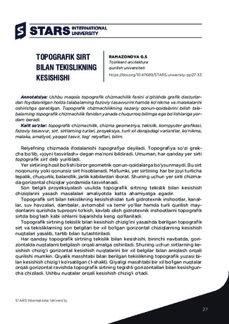 Topografik sirt bilan tekislikning kesishishi
Современные тенденции инновационного развития науки и образования в глобальном миреUshbu maqola topografik chizmachilik fanini o‘qitishda grafik dasturlardan foydalanilgan holda talabalarning fazoviy tasavvurini hamda ko‘nikma va malakalarini oshirishga qaratilgan. Topografik chizmachilikning nazariy qonun-qoidalarini bilish talabalarning topografik chizmachilik fanidan yanada chuqurroq bilimga ega bo‘lishlariga yordam beradi.
-
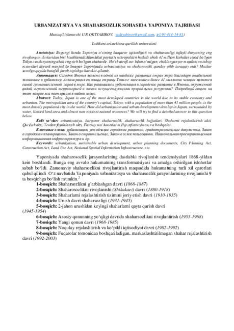 The Japanese experience in the field of urbanization and urban planning
Тенденции и перспективы развития городовToday, Japan is one of the most developed countries in the world due to its stable economy and urbanism. The metropolitan area of the country's capital, Tokyo, with a population of more than 41 million people, is the most densely populated city in the world. How did urbanization and urban development develop in Japan, surrounded by water, limited land area and almost non-existent natural resources? We will try to find a detailed answer to this question below.
-
Typological Features Of Traditional Settlements In Fergana
The American Journal of Interdisciplinary Innovations and ResearchThis article is intended to be used in the design of the Fergana traditional housing project. In solving the architectural and structural part, the formation of the functional basis of the rooms. Full demonstration and implementation of the functional spatial solution of the main rooms.
-
 Mathematical modeling and forecasting morbidity of cutaneous leishmaniasis in uzbekistanConducted comprehensive studies in endemic areas with the analysis of the spatial distribution of cases in relation to environmental factors and taking into account other risk factors such as socio-economic status of the community, the activities of carriers and / or CL tanks is essential to identify areas of high risk. In recent years, the widespread use of geographic information systems (GIS) for the analysis of risk factors associated with disease vectors usually used in the study of leishmaniasis in different countries. Definition of high-risk ar-eas of the disease is crucial to mobilize resources for health in order to reduce the disease. Analysis of the re- sults of predictive risk maps distributed in geographic space of great importance in the management of the control of leishmaniasis
Journal problems of biology and medicine -
THE USE OF EDUCATIONAL TECHNOLOGIES IN THE DEVELOPMENT OF PRESCHOOL CHILDREN
CURRENT RESEARCH JOURNAL OF PEDAGOGICSThe scientific article presents some didactic approaches to the formation of mathematical concepts in preschool children based on TIPS technologies. The methods and technologies of teaching children mathematics using developmental and logical games and exercises are revealed, the necessity of systematic preparation of children for mastering the school curriculum of mathematics is substantiated.